


What lies beneath the streets and sidewalks of New York is messy, confusing, and troublesome. This is obvious to any architect who’s been involved in site exploration and any citizen who’s encountered disruptions from watermain breaks or power-line repairs. Yet the below-grade city is less mysterious than it was just a few years ago. In the highly motivated community that studies “subsurface spaghetti” (the public and private utility infrastructure under the public right of way caused by New York’s direct-burial method), some dare to hope it could take an orderly form.
Thanks to studies in the public, private, and academic sectors, precise three-dimensional knowledge of the subgrade environment is becoming more accurate and more available to those who need it. That includes architects and planners, because the costs and risks associated with deteriorating infrastructure are rising—arguably already past the point where systemic upgrades, despite their up-front expense, offer better benefit/cost metrics than business as usual. Stressor events such as 9/11 and Superstorm Sandy, say redesign advocates, have shown that business as usual has downsides ranging from inconvenient to cataclysmic.
The quandary of entanglement
The space beneath the public right of way is a palimpsest reflecting public and private entities that have been burying infrastructure over two centuries. Subsurface resources provide water, sewerage, power (gas and electric), steam, telecommunications, and, of course, transportation. It is a realm of overlapping claims, unintended consequences, incessant repairs, and bad surprises.
“People maybe don’t appreciate how many decades of infrastructure are down there,” says Debra F. Laefer, Ph.D., professor of urban informatics at NYU. “We have stuff that dates back to the 1820s. Certainly by the 1840s there’s a lot of gas in New York City. By the 1880s there’s a lot of electricity. There’s a huge amount of telecom.” The city’s steam system dates to 1882, merged into Consolidated Edison in 1954. Con Ed and Empire City Subway (the 1891-vintage firm, now a Verizon subsidiary, that maintains underground conduits and manholes) operate as franchisees, with other telecoms renting space for cables and fiber optics, plus National Grid serving some outer-borough areas with gas. The Department of Environmental Protection (DEP) handles water, stormwater, and sewer service. State control of the Metropolitan Transit Authority (MTA) adds another administrative layer to any projects involving the subways.
No single entity knows the full scope of subsurface infrastructure. “Once something goes in the ground,” Laefer adds, “it rarely gets taken out, because the technology is not being used any more, or the company that owned it doesn’t exist any more. We have city, county, state, federal, and private stuff in the ground, and they don’t necessarily talk to each other.” Organizations have little incentive to share documentation, citing security, privacy, and business issues (telecom firms, for example, don’t want competitors knowing where they have or don’t have lines) among reasons for siloing. The city’s 3D mapping efforts, says Thomas Wynne, deputy commissioner for infrastructure at the Department of Design and Construction (DDC), are partial, comprising sewer and water systems, and coordinating with private utilities only on major projects or under emergency conditions. “What often comes out of disasters is a motivation to fix things, and people find the energy to do it,” he says. “I think it’s hard to sustain that energy. Over time you see things gradually go back to ‘the way we always do it.’”
David Burney, visiting professor of urban placemaking and management at Pratt Institute and former director of DDC, reflected on logistical, legal, and budgetary challenges for subgrade repairs and expansions. He recounts a common “knock-on effect” even above grade: when the Department of Transportation sought to aid pedestrians with intersection neckdowns, it would come to DDC for surveying. “It’s only 10 square yards of concrete—$50,000, off you go, do it,” he says. “But then what happens is there’s a sewer catch basin right where we want to put that concrete, so we need to move that catch basin. Actually, there’s a gas line and a water line on top of it, and before you know it, your $50,000 curb extension is a $2 million infrastructure project.“ Cost overruns often reflect unavoidable responses to such discoveries.
Proximity of systems increases vulnerability, particularly during extreme events. “One thing that’s driving a lot of the catastrophic failures,” says Rae Zimmerman, Ph.D., professor emerita of planning and public administration at NYU, “is the fact that a lot of the underground infrastructure is interrelated. Communication, electric power, and transportation are often running in the same geographic space underground, and are also functionally interdependent, and if one fails, the other one does.” From her studies of underground infrastructure failures, network theory, and stakeholders’ needs, she says, the city excels in emergency management but needs better-integrated approaches to design, operations, inspections, and communications: “one organization in charge” instead of “a hodgepodge of organizations and professional societies that suggest standards.”
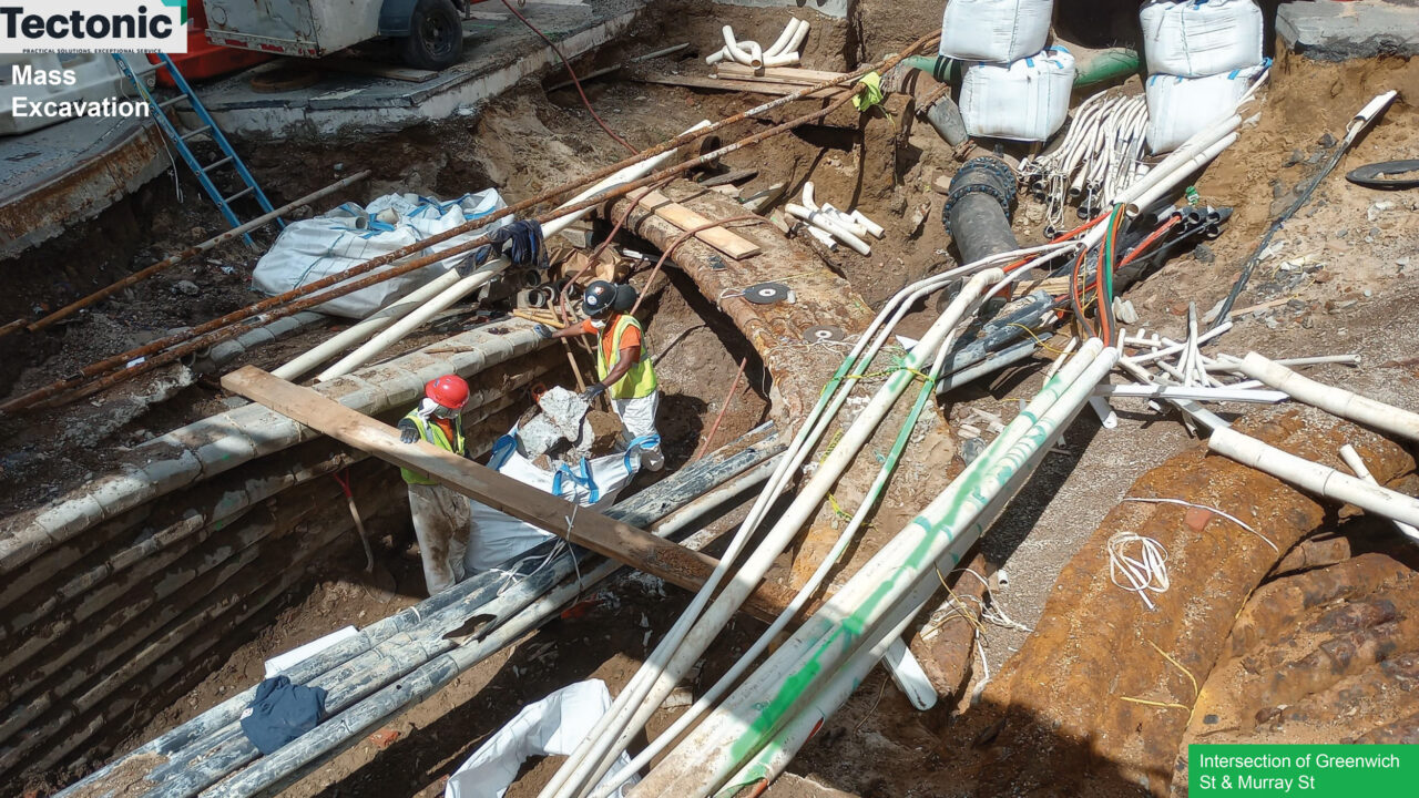
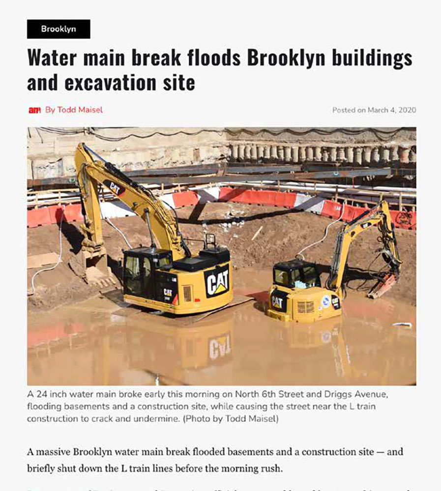
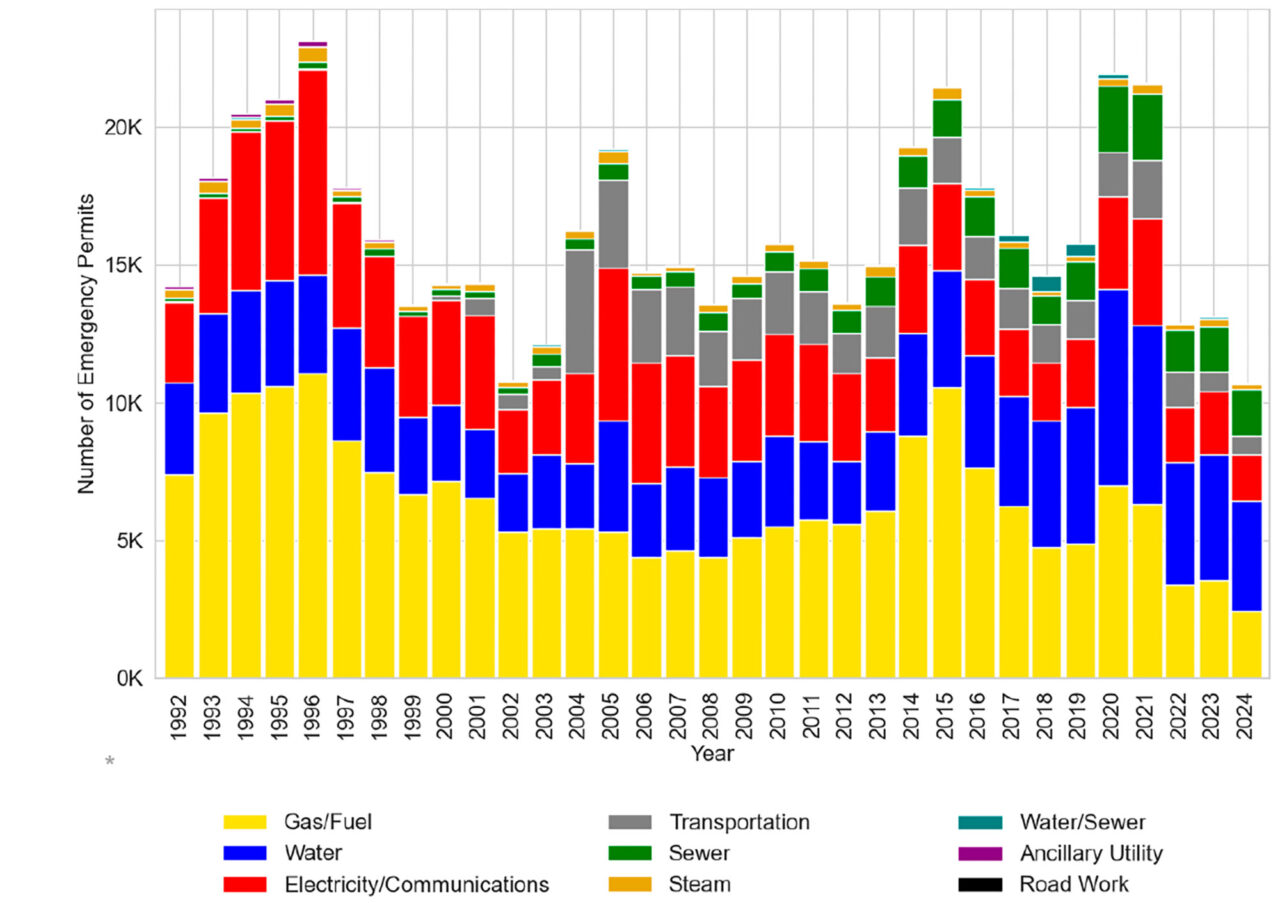
Beyond visible maintenance costs, a host of societal costs—indirect and hard to quantify, but no less real—follow from direct-burial spaces’ entangled conditions, patchy data, and poor coordination. Opening streets for repairs disrupts entire neighborhoods, and as Mark Reiner, Ph.D., PE, co-founder of analytics firm Acuitas 3D in Arvada, CO, observes from studies of street excavations since 1992, New York’s 7,000 miles of streets are cut open some 400 times a day. This creates pedestrian and vehicular obstructions and diversions, jackhammer noise, increases in particulate emissions, degradation of components from serial replacement and differential settling, and (when water mains are damaged) flooding. Laefer notes that despite the city’s pavement protection plan, “where they’re not supposed to touch a street that’s been recently paved for five years, the average time to first dig is less than a year. Not only does it create pollution and construction waste, but every cut decreases the lifespan of the pavement by several years.”
Reiner and colleagues have drawn data from open-source road-excavation permits, “the perfect source of information for a digital twin that nobody’s done yet,” he says, analyzing “key performance indicators” to develop a Disruption Occurrence Index, linked to City Council districts and demographic variables. He describes this work as “a long-term strategic planning tool for public works and urban planners, but also as a base of a digital twin to be connected to BIM, to the architectural community, to transport,” ultimately providing comprehensive, granular, updatable information guiding efforts to replace the spaghetti with resilient critical urban corridors. Envisioning a “Smart Appian Way,” Reiner contrasts the ancient road from Rome to Brindisi with the current “Road and Buried Infrastructure Decay (RABID) paradigm,” vulnerable to both chronic and acute (emergency-related) disruptions: “If the Romans could build a road that lasted 2,000 years, why can’t we?”
Obstacles to such improvements include the oft-cited paucity of political will. Reiner explains some officials’ response to long-range problems with the neologism NIMTO: “Not in My Term of Office.” Subsurface work is short on glamour. As Laefer notes, “It’s hard to have a ribbon-cutting ceremony for a pipe.” Still, projecting the likely future under the RABID paradigm, Reiner speaks for many who study this non-system: “Everybody knows it’s not going to get any better.”
Beyond Spilhaus and Mickey Mouse
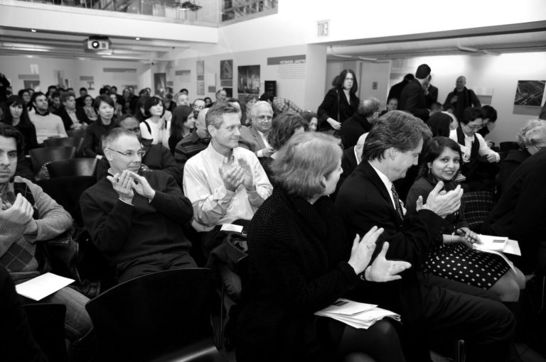
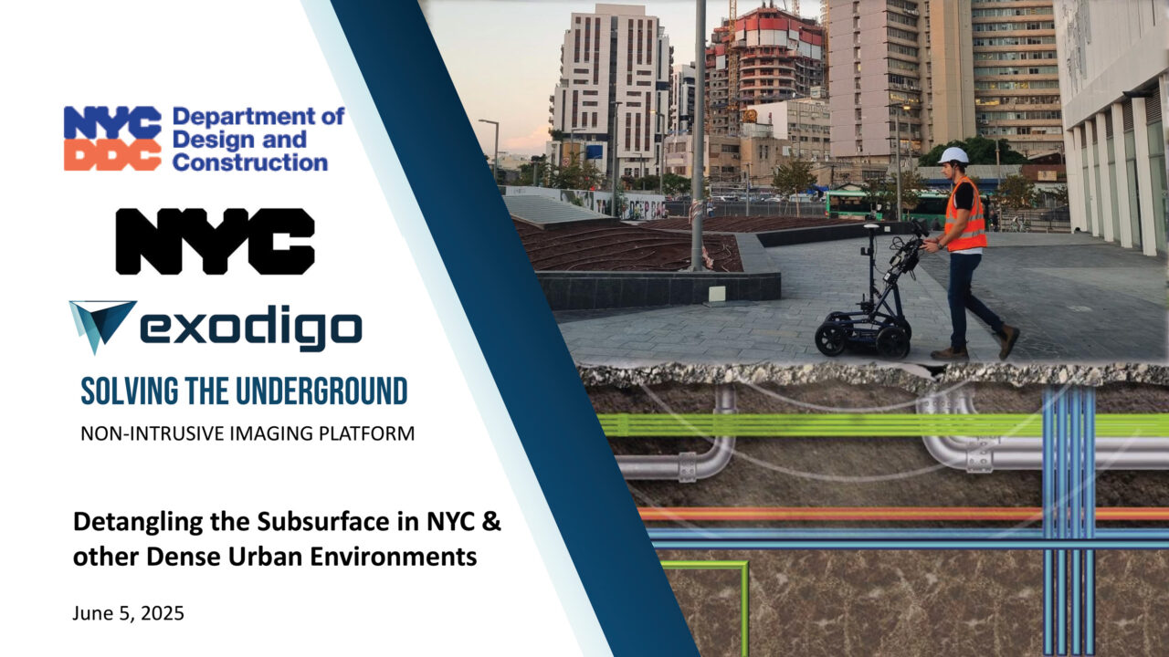
Since 2006, city agencies have been investigating ways to improve maintenance practices with less disruption and lower cost per mile. DDC’s Town+Gown program has led efforts to redesign subsurface space, culminating in three “Under the Ground” symposia (most recently on June 5, 2025) and the 2019 formation of a working group advocating a more accessible “system of systems”: multi-utility tunnels, a.k.a. utility corridors or utilidors.
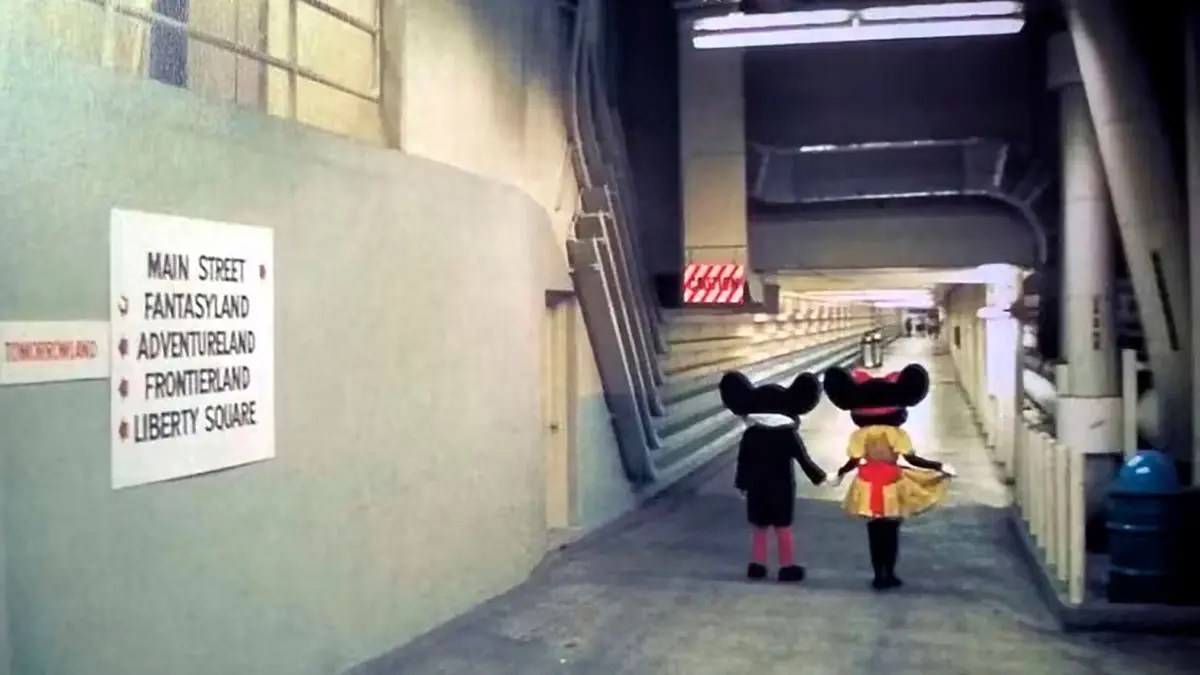
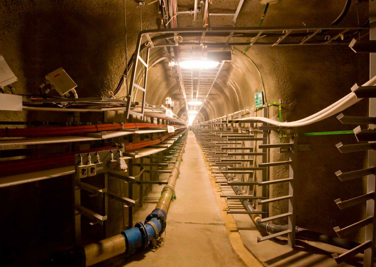
Utilidors are both commonsensical and retrofuturist; they were a feature of Athelstan Spilhaus’s never-built Minnesota Experimental City. Yet they are a reality in Tokyo; Prague; Singapore; Putrajaya (near Kuala Lumpur), Malaysia; and, famously, at Disney World, where a buried box-tunnel system, a solution for a swampy site, realizes Walt Disney’s intention to spare visitors the sight of maintenance crews or “cast members” out of costume. A few American academic, medical, and corporate campuses include utility tunnels; no American city to date has implemented the system on the full urban scale, yet long-term life-cycle-cost and full cost-benefit analyses by Town+Gown with scholars from Columbia, NYU, and other centers suggest that utilidor construction at certain sites vastly outperforms current practice, provided financing systems could cover the up-front costs.
Recent local projects have missed the chance to pilot a utilidor approach, Burney notes. Con Ed maintains multiple tunnels, including one under the Harlem River bringing power from a Yonkers substation to Upper Manhattan, but other opportunities to add utility spaces to new projects have fallen through. Burney cites the Second Avenue Subway and the Economic Development Corporation’s Hunter’s Point South, where “the developer looked at the numbers and said, ‘No, we’re just going to bury it in the ground like we always do.’” He recalls a DDC joint study with Con Ed exploring tunnel systems modeled on Japanese cases, but “the study basically ground to a halt for two reasons, legal and logistical.” Tunnel construction beneath a new street is straightforward; digging up existing utilities for retrofitting a new tunnel “means that nobody on that particular section of street has power or sewage or water or data” until completion, and with multiple utilities, staged downtime is not an option. “The lawyers had a field day” over ownership and leasing involving DEP, Con Ed, and Empire City Subway at Hunter’s Point South, Burney adds. “It would make sense, in my mind, for the city to own the utilidor and then to lease it out to the different utilities, but we never got to the point of testing that. So that’s where it died.”
New York’s subsurface conditions are severe but not unique. “The problem of utilities is global,” says Paul Nicholas, tunnel practice manager at AECOM’s Seattle office specializing in small-diameter microtunneling and trenchless horizontal directional drilling, who has lived in 16 countries and visited 135. “No one has really worked it out.” Essential utilities are treated as an afterthought in new housing, he notes. Still, the United States differs from much of the world in having utilities in corporate hands. “I think the ownership of utilities is where the problem starts,” he says. “The permitting requirements for construction in the U.S. are extremely complex and time-consuming, probably longer than any other country I’ve worked in. Whoever owns it doesn’t want to mix their space up with someone else unless there’s some mutual benefit to the numerous utility owners.”
Nicholas recalls a California project where a developer wanted utilidors in 100-foot spaces between new office buildings; AECOM began designing them, but the electrical, water, and fiber-optic companies refused to share space. “I don’t believe we’re going to see the development of utilidors in the U.S. until a city itself builds them and forces the utility corporations to use them,” he says. “They claim there are often safety issues of having power cables with sewers and water supply but, seriously, that can be dealt with in design.” London, in contrast, “has built probably nearly 100 miles of cable tunnels in the last 20 years,” unhindered by UK Power Networks’s private status (the U.K. privatized public electricity boards in 1989). “They have seen the advantage of investing in tunnels to place cables; it provides future savings that they have access at all times” for expansion.
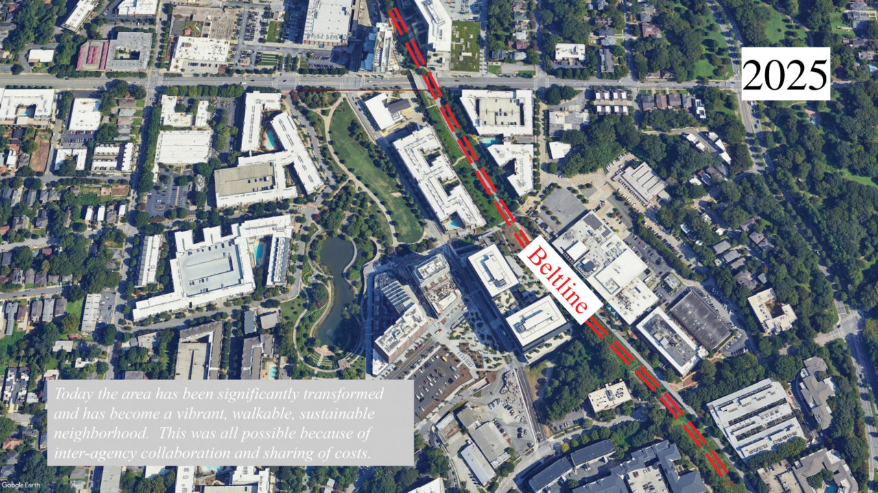
David Green, master planning urban design leader and principal in Arup’s New York office, cites a project in which architectural expertise transformed a routine intervention into a civic asset. In a flood-prone area with an underground creek near Atlanta’s Beltline and Ponce City Market, the Department of Public Works planned to spend $40 million on subsurface water-detention systems. “Architects got together,” Green recalls, “figured out how the underground systems were working, and said, ‘Well, this is crazy. We’ve got the Beltline right next to it. What if we rethought this and moved the water to surface water, created a basin, and that basin became the center of a park, and that park became the center of a redevelopment neighborhood?’ So instead of spending $40 million on this underground series of large culverts that would hold water, we now have a beautiful lake and park and billions of dollars of redevelopment.” Atlanta Beltline, Inc.’s 17-acre park served the stormwater-detention function, catalyzed higher-density development than originally planned, and came in at $23 million. “If we as architects can get involved in the front end, and we’re driving conversations about utilities-distribution issues,” Green comments, “we’re able to think beyond the project manager for a city agency who’s working with a specific utility to solve a specific problem. It’s in our nature to convene people from different disciplines to get these things executed.”

In mid-journey, the map begins to appear
Efforts toward a more robust utility system require better mapping of existing infrastructure and development of interoperable data-sharing systems. Wendy Dorf, who managed geospatial information systems (GIS) for DEP and is now on the board of directors of NYC Geo-spatial Information Systems and Mapping Organization (GISMO), spent 10 years digitally mapping the city’s water system. She then worked with geospatial specialist Alan Leidner (then of the Department of City Planning) after 9/11, combining underground data with a topological map. Among other achievements, using infrared imaging to identify underground fire sites and locating a 200,000-pound freon tank, they helped prevent a secondary disaster: had the fires reached the freon, a lethal cloud of phosgene, a chemical-warfare agent banned by the Geneva Convention, would have added to Ground Zero’s woes.
This emergency-driven work led to the Unification for Underground Resilience Measures (UNUM) project supported by the National Science Foundation (NSF), focusing on two demographically contrasting sites, East Midtown and Brooklyn’s Sunset Park. UNUM researchers, including Dorf, Laefer, Leidner, Zimmerman, and others, work with a standards organization, the Open Geospatial Consortium (OGC), to create a federated protocol that recognizes different stakeholders’ security requirements, letting them retain data within their environments while providing an encrypted medium for exchange on request. For the second phase of UNUM, NSF has granted the city $10 million to continue subsurface documentation: benefits include a step toward electrification of municipal fleets—an environmental goal of the Department of Citywide Administrative Services—and toward expansion of charging networks for electric vehicles, a form of aboveground change that requires the subsurface environment to evolve. OGC’s Model for Underground Data Definition and Integration extends ideas explored by UNUM toward standards that can function in any location, overcoming siloing among GIS, BIM, and digital-twin systems. The work is also guided by the surveying and documentation standards of the American Society of Civil Engineers (ASCE), ASCE 38 and 75, pertaining to existing and new infrastructure.
Leidner is optimistic that advances in imaging technology are approaching the holy grail of comprehensive 3D underground mapping, capable of connection with aboveground BIM. With multichannel ground-penetrating radar (GPR), “you could drag it behind a truck and go 40 mph and capture finely located geo-imagery of what’s underground,” he says. “You can cover a lot of ground quickly, and that would reduce costs.” Time-delineated electromagnetics and acoustic imaging help overcome the depth limitations of GPR, estimated at roughly 10 feet. Synthetic-aperture radar sensors, a satellite-based Doppler technology, can “identify those areas where subsurface conditions would lead to conflict between different kinds of pipe that could lead to explosion.” Another approach Leidner finds useful is the borehole soil studies of George Deodatis, professor of civil engineering at Columbia, who is “compiling an underground map of the geology of the city, based on 20,000 samples that are taken routinely but were never digitized or modeled together.” Combined with DEP and MTA records, Leidner says, “there are multiple sources of data that you can use to create an almost comprehensive picture of what’s underground. Let’s say it’ll get you 95% of what you really need to know most of the time.”
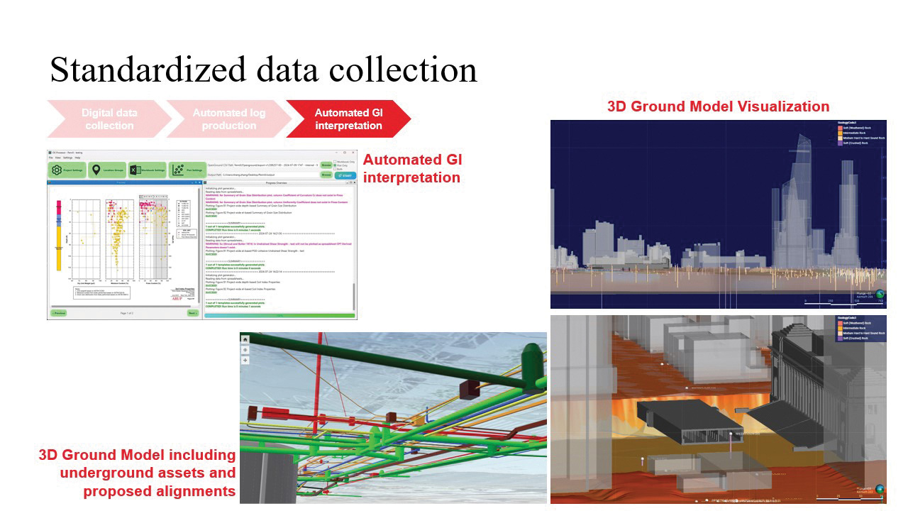
Engineers and planners overseas, Leidner points out, are ahead of the U.S. in creating and integrating models. “The U.K. is creating an underground network of all its utilities across the entire country in a project called NUAR, the National Underground Asset Register,” he says. “It’s already happened in Denmark, Flanders, Belgium, and the Netherlands.” Still, New York “has allocated $10 million to create its 3D underground mapping project, which will, working with the utilities, begin the process of mapping all underground utilities and marry that to George Deodatis’s work to integrate the borings. New York is going to be the pilot project nationally for this kind of 3D depiction of the underground.”
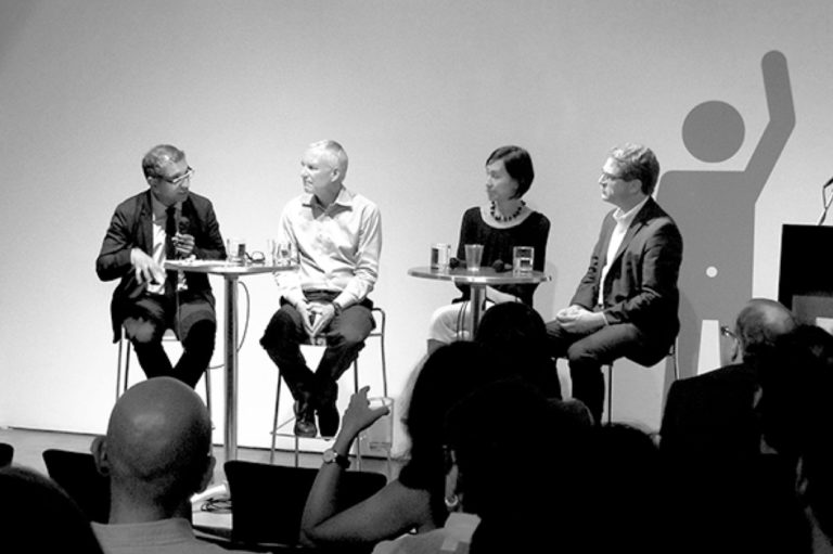
More sophisticated modeling of interactions between environments underground and aboveground, natural and built, Leidner says, will help architects anticipate risks affecting their buildings, climatic and otherwise. “It’s all starting to come together now, and architects need to be part of this, because they need all that data. They’re going to need it integrated and standardized, and it will probably simplify the design process.” Terri Matthews, director of Town+Gown and organizer of the June symposium, notes that participants emphasized the need for data collaboration from the design phase through the construction phase. Joint bidding could help accomplish better subsurface project management; likewise, NYC permit data and other public sources can identify potential subsurface vulnerability and help make subsurface planning as rigorous as surface planning. One popular symposium proposal suggested rethinking local franchise agreements to help develop new models of public-private collaboration. “It was said that we’d have to go back 100 years to fix this,” says Matthews. “But understanding the history of how subsurface spaghetti happened will help us chart a future course.”
BILL MILLARD (“Rethinking the Unglamorous Underground”) contributes regularly to Oculus, The Architect’s Newspaper, Metals in Construction, Annals of Emergency Medicine, and other publications. His book The Vertical and Horizontal Americas, assisted by a Graham Foundation grant, moves glacially forward.