
![+StL: Growing an Urban Mosaic by Object Territories; [dhd] Derek Hoeferlin Design; and TLS Landscape Architecture. Image: Object Territories.](https://www.aiany.org/wp-content/uploads/2019/01/StL-Growing-an-Urban-Mosaic-03-320x286.jpg)
![+StL: Growing an Urban Mosaic by Object Territories; [dhd] Derek Hoeferlin Design; and TLS Landscape Architecture. Image: Object Territories.](https://www.aiany.org/wp-content/uploads/2019/01/StL-Aerial-at-Night-320x213.jpg)
![+StL: Growing an Urban Mosaic by Object Territories; [dhd] Derek Hoeferlin Design; and TLS Landscape Architecture. Image: Object Territories.](https://www.aiany.org/wp-content/uploads/2019/01/StL-Spaghetti_Archeology-Museum-320x213.jpg)
![+StL: Growing an Urban Mosaic by Object Territories; [dhd] Derek Hoeferlin Design; and TLS Landscape Architecture. Image: Object Territories.](https://www.aiany.org/wp-content/uploads/2019/01/StL-Long-Table-320x213.jpg)
![+StL: Growing an Urban Mosaic by Object Territories; [dhd] Derek Hoeferlin Design; and TLS Landscape Architecture. Image: Object Territories.](https://www.aiany.org/wp-content/uploads/2019/01/StL-Bridge-Overlook-320x213.jpg)
![+StL: Growing an Urban Mosaic by Object Territories; [dhd] Derek Hoeferlin Design; and TLS Landscape Architecture. Image: Object Territories.](https://www.aiany.org/wp-content/uploads/2019/01/StL-Bridge-at-Forest-Park-320x213.jpg)
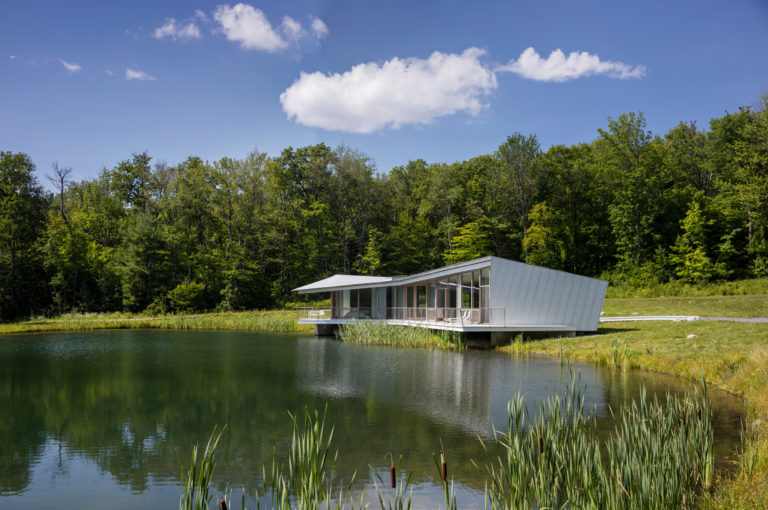
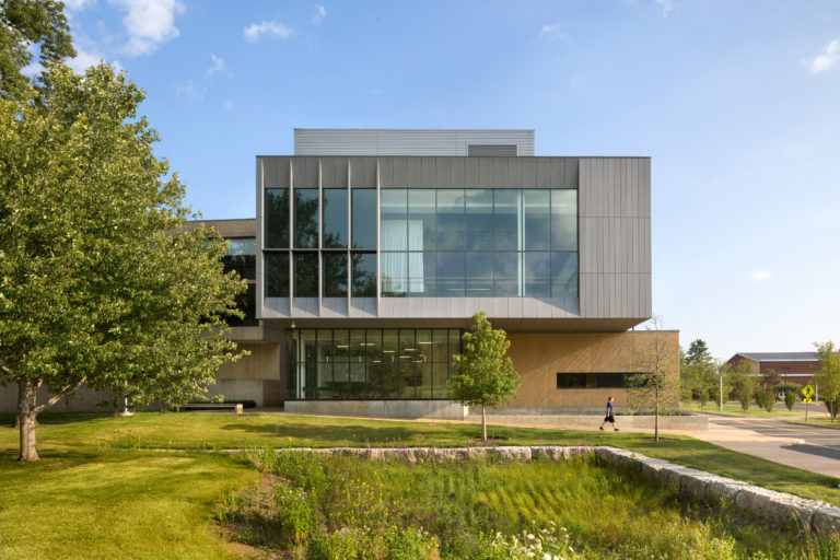
A contradiction is facing the urban space situated between Forest Park and the Mississippi River at the proposed Greenway. Running east-west in a shallow valley at the center of the city: A 20th century infrastructure connects the city to its region and to the nation via I-64, the freight rail, and Amtrak rail. At the same time, this infrastructure forms a dominant physical and psychological barrier between the Central West End, Midtown, Downtown, and North City and neighborhoods to the South. This thickened band of movement and industry sliced into the gridiron of St. Louis can now only be crossed at major arteries. Only a radical re-conception of this infrastructural band can bridge the north-south divide and become the primary artery of the Greenways system. A bold investment in public space is required to unite divisions, remediate industry, add amenities, incentivize development, and provide alternate means of movement in a multi-modal city. +StL proposes to visibly and physically join North and South at the central East West corridor. We believe that the greenway must extend at least as far North and South as it does East and West. This figure builds on connectivity and investment planning already underway by local partners, but also provides a multi-dimensional armature for future projects by Great Rivers Greenway, Trailnet, and others. Through this armature we intend to grow a new urban mosaic for St. Louis, built on unique cultural identities, histories revealed, shared ambitions, and a new connective and productive greenway for St. Louis.