

Beyond Charcoal Analysis
As a practicing professor invested in developing urban design curricula, I’d like to remark on 100 years of New York City zoning history as an opportunity to contemplate the role of visualization in the advancement of human progress in cities. Let’s think about the future of zoning by looking at what our young professionals are thinking about in cities and how they are thinking it.
Today, New York City’s current planning priorities of housing, livability, economic development and resiliency and sustainability are only vaguely linked to zoning. Textual descriptions support these conceptual connections, as they did a century ago. The next generation of New York zoning will need to be more visually insightful, presenting socioeconomic and environmental factors with the spatial consequences that zoning brings to light, in order to enhance comprehension. This also needs to take place at multiple scales. It means two big things should be happening in practice: it means getting ramped up with data-conducive ways of working, and it means crafting messages to story-tell the technical manifestations of complex urban issues like zoning to the communities that will be impacted.
Current programs in urban design education are already exploring this junction through experimentation with visual techniques which involve moving images working at multiple scales. Mindful new graduates are crucial to discovering new ways to study zoning. The following indicates a stimulating new spirit in zoning.
Formative Texts: Zoning at Work
Access is elemental to equity. Access to data, in essence, is projective and enables designers to gain more insightful understandings into neighborhoods and place over time. Access to low-cost modeling software, synergized with an online, global sharing community and increasing computing power, is a recipe for innovation.
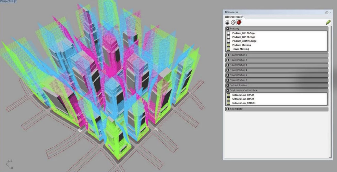
The beauty of the digital cultural space that exists today moves far beyond the elegant charcoal zoning envelope studies created by one of planning’s most celebrated New Yorkers, Hugh Ferriss. Computational design, already widely used in architectural design, has been adopted to study city, district and block scales. For instance, the New York Zoning Resolution text can be translated into Grasshopper’s nimble user interface for visual study with the camera in Rhino. 3D building bulk and setbacks can be scripted with analogous relationships to variables such as Length of Front Lot Line, Length of Encroachment, Depth of Setback Line, etc.
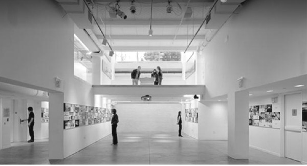
The remarkable moment here is less the translation from legal text into graphic representation but rather the potential that modeling tools offer to engage with other professionals, officials and the community at large. They can be utilized as inclusive collaboration tools, affording meaningful conversations across stakeholders early on in the design process; this creates a space of time to respond to “tangible” speculations about urban form and bring greater transparency into the often opaque process of zoning study. Disparate relationships shaped by the built environment are made legible by interactive slider bars and dynamic annotations. As non-designers are able to witness how the tools work, their ability to make sense of the symbiotic relationships of zoning action increases. As a result, the entry point to zoning is widened; the craft of the “drawing” has changed from what it looks like, to how it is dynamically utilized and to whom it can speak.

Hot in Here: Zoning at School
In an academic lab setting, graduate-level urban design students are encouraged to explore New York and its rich history while learning new software. Immediately the 1811 commissioner’s grid and the 1916 and 1961 zoning ordinances become important precedents that surface alongside open space networks and concepts like “the right to the city.”
In a video piece called “Manhottan Island,” students fast-forward to a distant future, imagining the Manhattan fabric rezoned. A fundamental principle of radiator fins informs a micro- to macro-scale approach to strategize how zoning regulations could support a future urban habitat that hosts new species on new waterfronts, terraces and urban landscapes. New modes of representation are activated in order to connect the multiple dimensions of building form, urban space and time to environmental and social performance, as well as to human experience. Through animated models and storytelling, the future of zoning is instrumentalized by a combination of tools, issues and minds that engage in the making and viewing of the moving image by emergent urban designers.

Zoning+
From early charcoal renderings, to analytical diagrams, to user-friendly zoning handbooks, designers and the communities they design for are becoming better and better equipped to work through the disparate relationships between the quantitative built environment and a qualitative aspirational future, that is, quality of life. Access to innovative tools will be key to extending new dimensions of empowerment for the designers who author urban futures and for the communities that are often overwhelmed by all the possible impacts that may affect their everyday lives.
Regulatory frameworks like zoning are already being supplemented with sociocultural material; the ZoLa web-based tool is one place to view the evolution of zoning, or “zoning plus.” But they are hardly inspiring artifacts like the Ferriss renderings that continue to resonate with energy. Beautiful illustrative forms of communication will emerge from the integration of city issues and climate change response as design practices advance the idea of zoning. Zoning manages population and physical density like it did 100 years prior, but what will influence zoning’s innovation in NYC will be creative uses of visualization. Be on the lookout for new techniques and the stories that embed these advancements in the design fields.
Phu T. Duong, AIA, LEED AP, is a Senior Associate in the Urban Environments practice at NBBJ, and Adjunct Professor at Columbia University Graduate School of Architecture, Planning and Preservation. He is a Board Member on Brooklyn Community Board 8.