


On a bright and brisk morning recently, high above New York City’s eastern coastline, a pair of bald eagles circled overhead as a park ranger watched from below. In the surrounding grasslands, northern cardinals and red-winged blackbirds sang from their refuge. Just blocks to the north, a different symphony unfolded: sirens wailed, a tractor trailer downshifted, and the A train clattered along its elevated track. The convergence of these two contrasting worlds typifies the new Arverne East Nature Preserve, designed by landscape architects Starr Whitehouse.
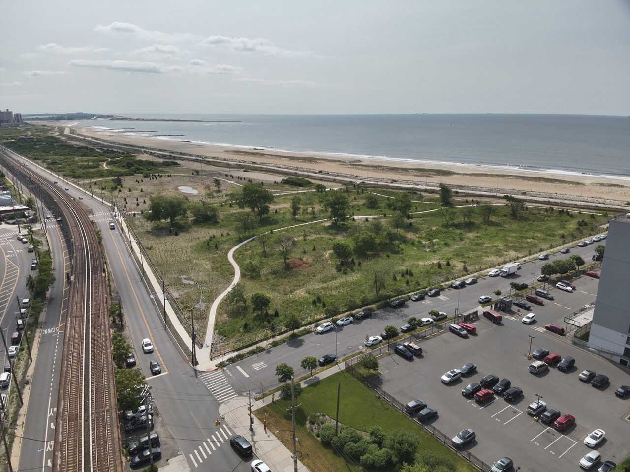
The preserve occupies a 35-acre site on the Rockaway Peninsula in Queens, part of a barrier island system along Long Island’s southern shore. Within the dense Arverne and Edgemere neighborhoods, it is wedged between a roadway and the elevated subway to the north and, to the south, a popular boardwalk, which skirts a broad, sandy beach. Once a vacation retreat filled with bungalows and hotels, the area long ago fell into decline and, following various urban renewal efforts, has become a patchwork of large public housing developments, prewar single-family residences, mixed-use projects, and vacant lots.
Following the 1968 establishment of the Arverne Urban Renewal Area (the earliest iteration of the redevelopment effort for the two-mile stretch), a Final Environmental Impact Statement (FEIS) laid out, in 2003, the current development parameters for the area. In 2006, the city issued an RFP for a 116-acre parcel at the site’s east end, which is envisioned as a large net-zero, mixed-use project with affordable and market-rate housing. To mitigate the impact of the construction, a nature preserve—which would restore and promote the fragile ecology here and be owned and maintained by the New York City Department of Parks and Recreation—was mandated as the first phase of the plan.
The land designated for the preserve was overgrown and derelict, crisscrossed with crumbling roads, and used as an illegal dumping ground. Nonetheless, Starr Whitehouse’s team immediately saw its potential as a diverse and vibrant maritime habitat. “When I first visited the site,” recalls Starr Whitehouse partner Laura Starr, “I thought, Wow! What an opportunity to create a maritime forest for this community and for all of New York.” To the east were natural dunes, grasslands, and shrublands with an intact habitat of bayberry, winged sumac, and red cedar. The west side, though ensnared in a tangle of invasive trees and plants, had an appealing hilly topography—to facilitate a tour, the contractor came with machetes. The southern portion of the site along the beachfront is designated a Coastal Erosion Hazard Area, which limits grading and landscaping.
While the FEIS dictated keeping the preserve as natural as possible, the design team soon learned through its conversations with the community that creating this kind of wilderness would alienate the residents and render the site—a critical connector between the neighborhood and the boardwalk—unsafe at night. It needed to include direct, well-lit paths. And it needed to demonstrate that it would serve not just nature, but also people. (Restrictions to protect the nesting grounds of the endangered piping plover already prevented use of an adjacent stretch of beach for recreation.) “The community’s input changed the team’s approach,” says Starr. “Because the preserve is in an urban area, the human system needs to integrate with the natural system—it moved from being a pure nature preserve to an urban nature preserve.” While promoting maritime flora and fauna in a naturalistic landscape (and counteracting storm surge in this flood zone), the preserve would simultaneously become an immersive retreat for a historically underserved community and other visitors. Reenvisioning the scheme to meet this critical need required coordinating among the numerous stakeholder agencies involved in city projects, adding another layer of complexity.

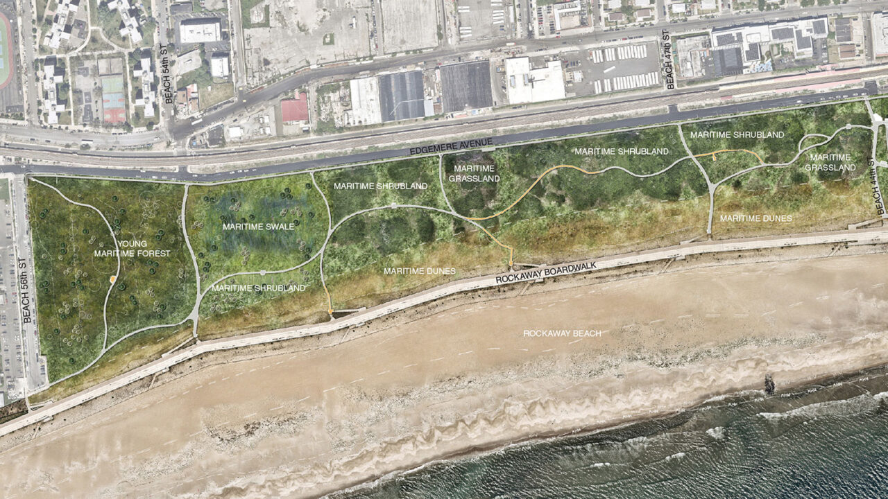
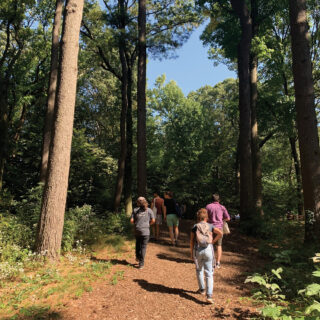
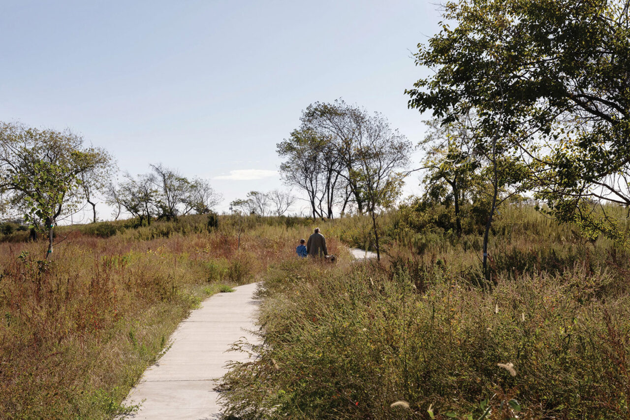
To reframe the site’s perimeter, the team specified new sidewalks and curbs (with cuts from the street to channel stormwater runoff into a system of bioswales) and a low, single-rail timber fence. The preserve includes five habitat types: a maritime woodland at the hilly western end, dunes skirting the boardwalk, and shrublands, grasslands, and wet meadows to the north. Team members built on plant populations that were already successfully established, like American beachgrass, seaside goldenrod, and beach plum, specifying a variety of sizes to create a multilevel canopy. They also retained certain non-native species that were thriving, such as Japanese black pine, which had been planted by RISE, a local community organization long invested in improving the derelict site.
The existing condition was also remarkable for its hodge-podge of soil conditions mixed with rubble. While the team removed a swath of asphalt, it left the soil largely untouched. That was one of the challenges, says Starr. “We couldn’t do a lot of regrading or bringing in soil—it was not in the budget,” she says. “We had to accept the conditions as they were, which, in a way, made it a testing ground for what can grow when you do the minimal amount of soil remediation.”

A series of footpaths crosses the preserve. Running north to south, from the street to the shore, they are straight and direct. Those running east-west meander, creating a “journey” through the landscape. Circumnavigating sensitive plant communities, the paths are largely concrete, though Starr Whitehouse also incorporated recycled plastic lumber boardwalks—a move that, along with interpretive signage, make the site feel like a nature preserve.
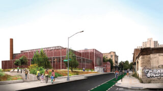
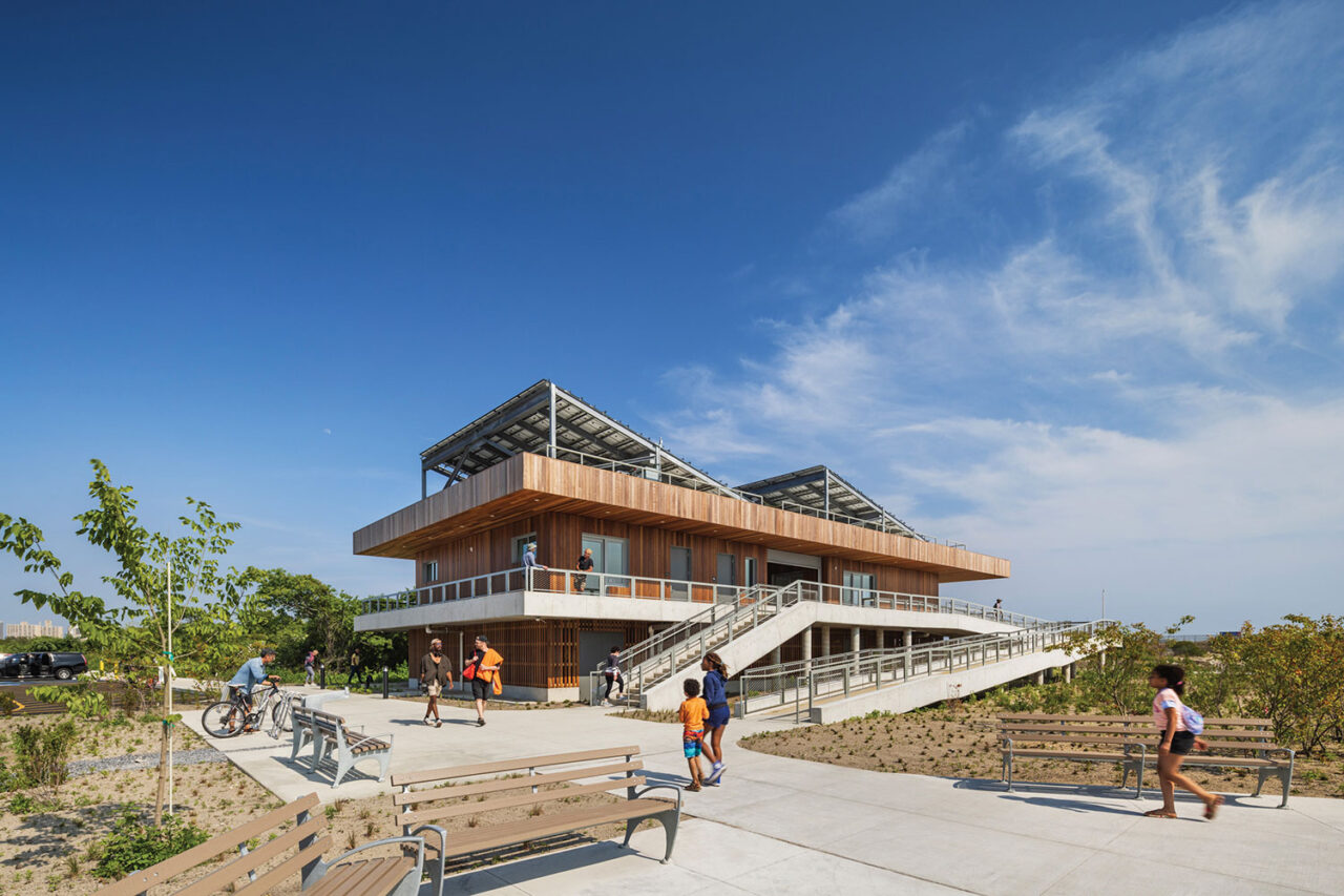
Importantly, paths connecting to the community are illuminated with black-painted pole lighting selected from the Department of Transportation’s approved list. To accommodate the trucks that service the fixtures, paths were widened, straightened, and strengthened. A handful of “seating nodes” with simple benches acknowledge the preserve’s role as a community amenity, and at the site’s eastern end is a handsome, sustainable 5,000-square-foot wood-clad building designed by WXY. This houses a ranger station and classroom space, which is a hub for educational programs.
These programs will be a key ingredient to the Arverne East Nature Preserve’s success. “This is a new type of landscape, and it needs stewardship and programming,” says Starr. “The more people who use the preserve in positive ways, the more momentum it will gain as a nature destination for New Yorkers.”
Arverne East Multipurpose Building
Designed by WXY, the preserve’s multipurpose welcome center, community room, and gender-neutral public washroom provides a built demonstration of “living with water” in the sense that this public building shows through its design how resilient, accessible, and shade- and light-conscious a net-zero building can be.
BETH BROOME (“Street Level”) is the former managing editor of Architectural Record and a writer based in Brooklyn.